A street-by-street air quality map for Dublin city has been released by Dublin City Council. The Google's Project Air View initiative measured the air quality of Dublin city's streets over a 16-month period and gathered over 50 million pieces of data |
The Google's Project Air View initiative measured the air quality of Dublin city's streets over a period of 16 months and gathered over 50 million pieces of data.
However, the streets along the quays on either side of the River Liffey in the city centre show relatively elevated Nitrogen Dioxide levels compared to other streets, which could be higher on account of the congestion levels on these quays.
Ireland Latest News, Ireland Headlines
Similar News:You can also read news stories similar to this one that we have collected from other news sources.
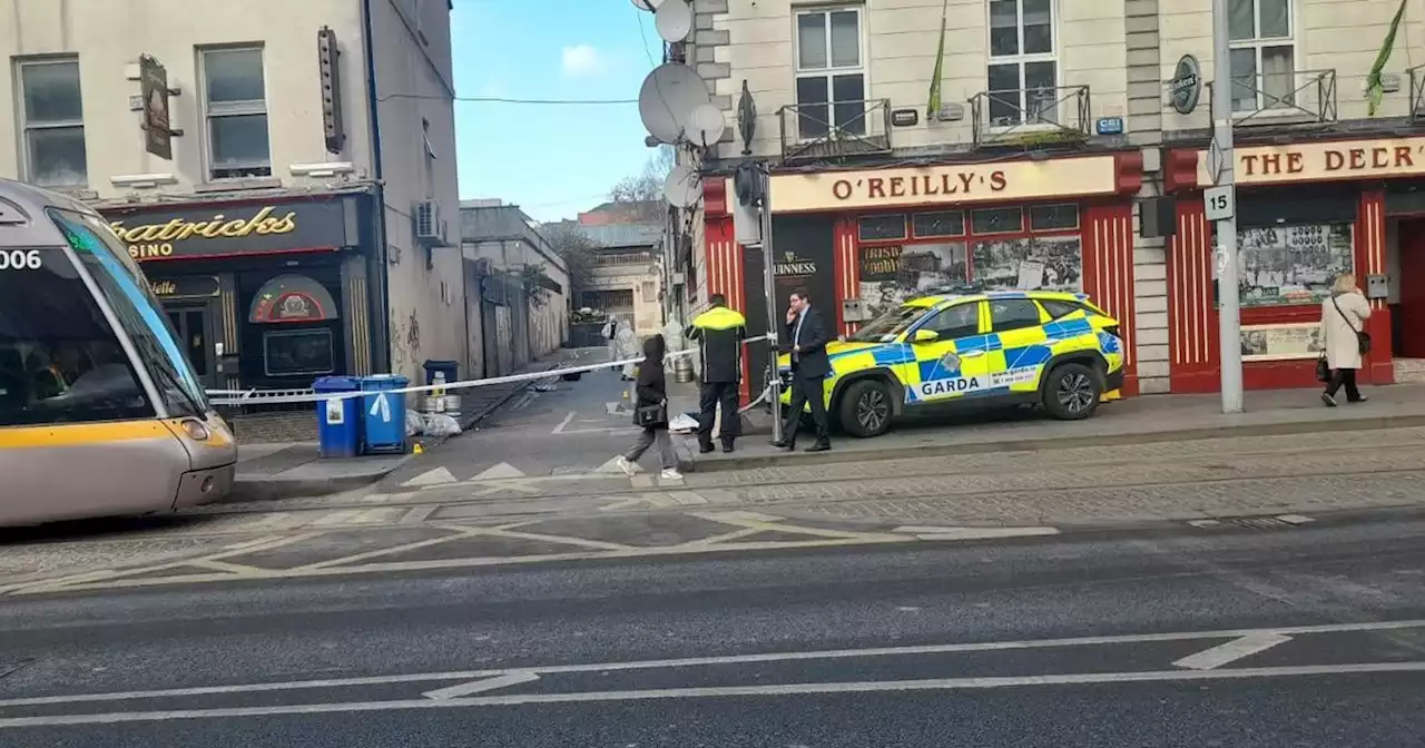 Live updates as Dublin street cordoned off following incident in city centreA Garda car remains at the scene of an incident near Parnell Street in Dublin city centre as forensic experts investigate
Read more »
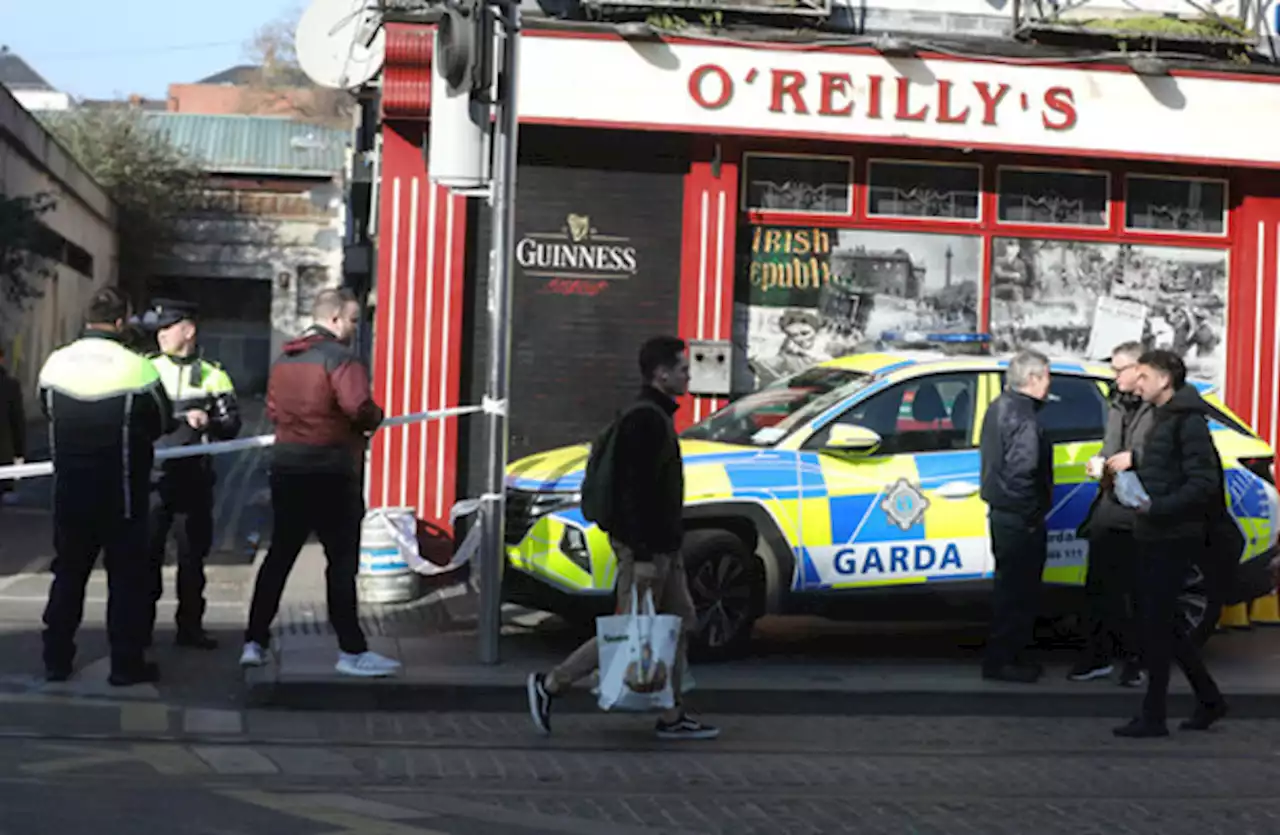 Man in critical condition following assault in Dublin city centreA man in his 20s has been taken to Beaumont Hospital after a serious assault that took place between 4am and 5am this morning.
Read more »
 Dublin city councillors authorise legal defence of development planPat Crean of Marlet’s constitutional challenge centres on decision to change zoning of site beside St Anne’s Park to ‘open space’ use
Read more »
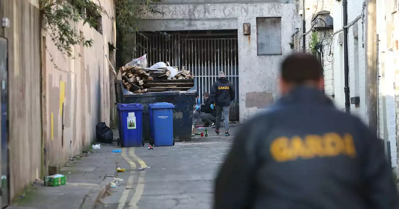 Man (20s) critical after north inner city Dublin assaultAssault happened in laneway off Parnell St between 4am and 5am on Monday morning
Read more »