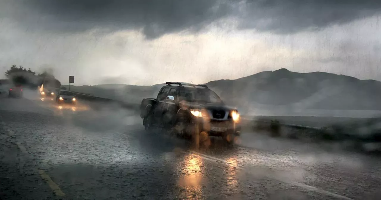
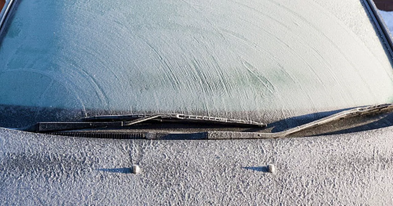
Ireland is set for a prolonged period of stormy weather, with rain, strong winds and generally unsettled conditions expected to dominate. Met Eireann's forecast warns of multiple low-pressure systems moving across the Atlantic, bringing heavy rainfall and gusty winds throughout the week and extending into next week. The national forecaster predicts difficult driving conditions, localized flooding and a persistent damp chill.
Ireland is bracing for a significant shift in weather, with a series of miserable events set to sweep the country. Met Eireann 's latest forecast signals an extended period of stormy conditions, with relentless rain, strong winds and generally unsettled weather dominating.
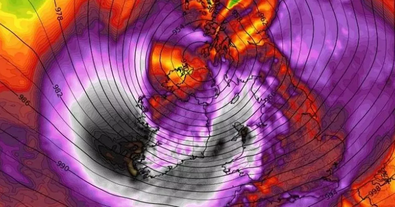
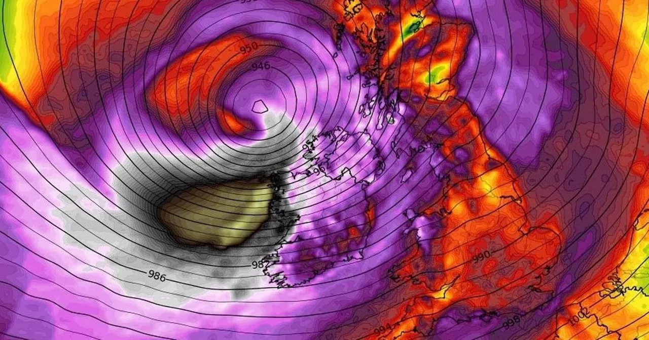
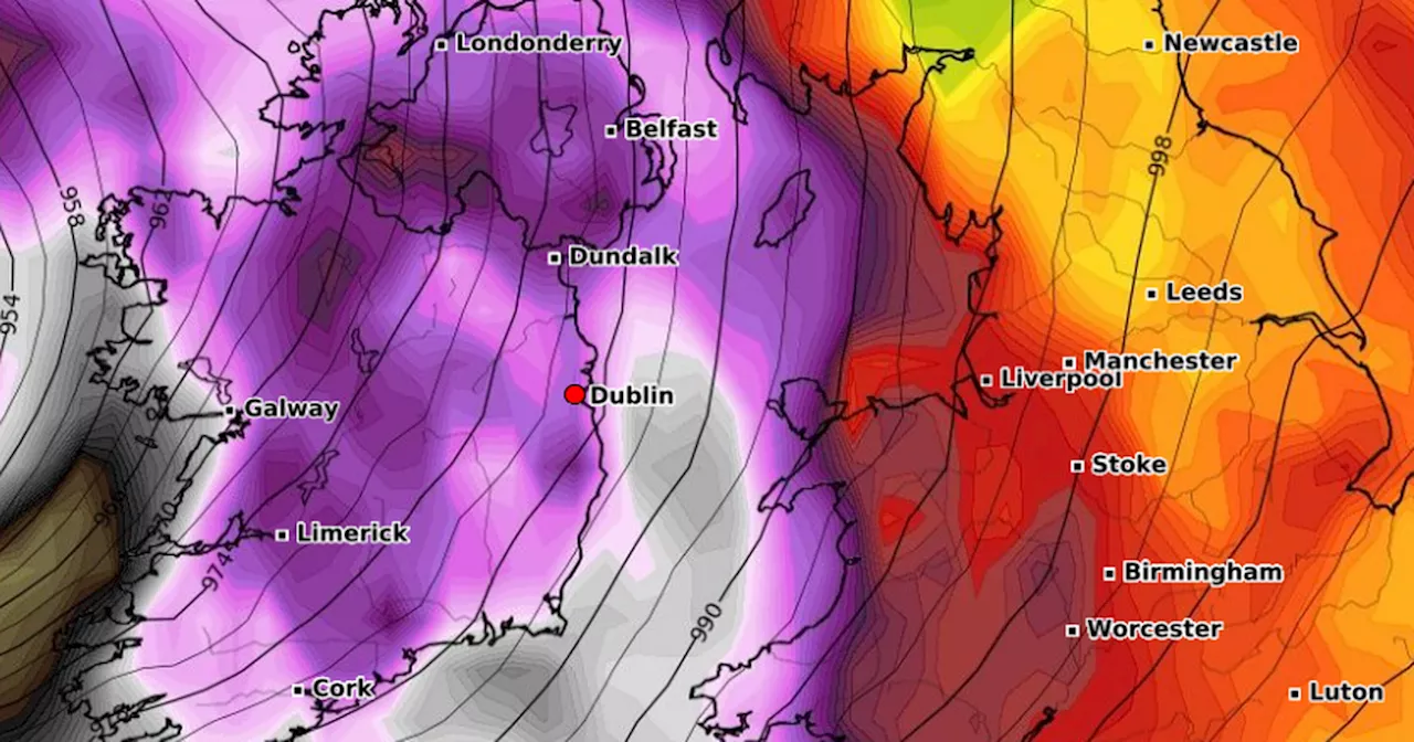
The official outlook for the rest of this week - and beyond - paints a grim picture as multiple low-pressure systems moving across the Atlantic are forecast to bring frequent spells of rain and gusty winds to most parts of the country. Met Eireann's current indications suggest that these low-pressure systems will dominate Ireland's weather for at least the next week, resulting in damp, windy and cool conditions. Starting with heavy rain and gusty winds today, the national forecaster says conditions will continue to worsen. By Thursday and Friday, near gale-force winds are likely to batter western and southern coasts, with heavy rainfall causing difficult driving conditions and the potential for localised flooding. The rain will continue throughout the weekend, with widespread drizzle and showers affecting nearly every part of the country. Giving a day-by-day breakdown of the rest of this week's weather, Ireland's weather service said: 'It will be mostly cloudy again Thursday, with patchy outbreaks of rain and drizzle for a time in the morning before easing off. Becoming windy through the afternoon, with more persistent rain spreading from the southwest in the evening. Highest temperatures of 5C to 7C , with moderate to fresh and gusty southeasterly winds increasing strong to near gale force in coastal parts. 'Mostly cloudy to begin on Friday with scattered outbreaks of rain and drizzle. Drier, brighter and milder conditions will push in across much of Munster and southern and western parts of Connacht by the afternoon. The cool, dull and damp conditions will persist further north and east though. Highest temperatures of 5C to 8C generally but milder across Munster and south and west Connacht with highs of 9C to 12C . Gusty east to southeast winds will ease light to moderate southeast or variable by the afternoon. 'Although there is still some uncertainty in the exact details, current indications suggest Saturday will be cloudy with scattered outbreaks of rain and drizzle moving up over the country from the south through the day. Highest temperatures of 6C to 10C, mildest in the southwest. Mostly moderate east to southeast winds will be fresher near Atlantic coasts. 'Confidence in the forecast for Sunday is lower than is usual at this time frame. A continuation of mostly cloudy conditions with rain and drizzle moving into the south and west and possibly spreading further northeastwards seems probable. There is a chance of some drier and brighter periods developing for a time too, though. Highest temperatures of 5C to 10C , highest in the southwest in moderate, occasionally fresh southeast winds.' The misery doesn't stop there as Met Eireann’s long-range forecast predicts that these unsettled conditions will extend well into next week. Low pressure systems are once again set to dominate, keeping rainfall totals higher than usual, especially across the south and west, where heavy bursts of rain could lead to flooding. Temperatures will remain cool, hovering around average, but the persistent dampness will make it feel colder. For the week of Monday, February 17 to Sunday, February 23, the national forecaster said: 'This week is signalled to be unsettled with low pressure to Ireland’s southwest dominating our weather. This will steer frontal systems across the country through the week with frequent spells of rain leading to wetter than average conditions for most of the country. However, rainfall will be closer to normal near northern coasts. Temperatures will be approximately normal for most areas with the exception of the northwest where it will be slightly cooler than average. With nearby low pressure, strong winds are possible at times.' With no clear end in sight, it’s shaping up to be a difficult few weeks ahead, as Ireland faces the potential for a total washout
Ireland Weather Forecast Met Eireann Storm Rain Wind Flooding Low Pressure
Ireland Latest News, Ireland Headlines
Similar News:You can also read news stories similar to this one that we have collected from other news sources.
 Ireland Braces for Stormy Weather With Strong Winds and Heavy RainfallMet Eireann warns of severe weather conditions including strong winds, damaging gusts, and heavy rainfall expected to hit Ireland on Thursday night and Friday. Weather warnings are anticipated in the coming days.
Read more »
 Fog Warning Issued for Ireland as Stormy Weather ApproachesMet Éireann issued a Status Yellow fog warning for much of Ireland on Monday morning, with hazardous traveling conditions expected. The warning coincides with predictions of stormy weather later this week and heading into the weekend, fueled by a 'conveyor belt of storms' brewing in the Atlantic.
Read more »
 Ireland to Face Stormy Weather with Potential for Sleet and SnowMet Eireann has issued a Status Yellow fog warning for Ireland, valid from 8PM on Monday, 20 January until 11AM on Tuesday, 21 January. A colder week is expected, with the possibility of sleet or snow on Friday as a storm system approaches. Alan O'Reilly from Carlow Weather warns of further storms next Monday and Wednesday.
Read more »
 Met Eireann Issues Weather Update: Cold Weather and Potential Sleet in IrelandMet Eireann forecasts cold weather, breezy winds, and light rain for most of Ireland this week, with potential for sleet over higher ground. Milder conditions are expected next weekend.
Read more »
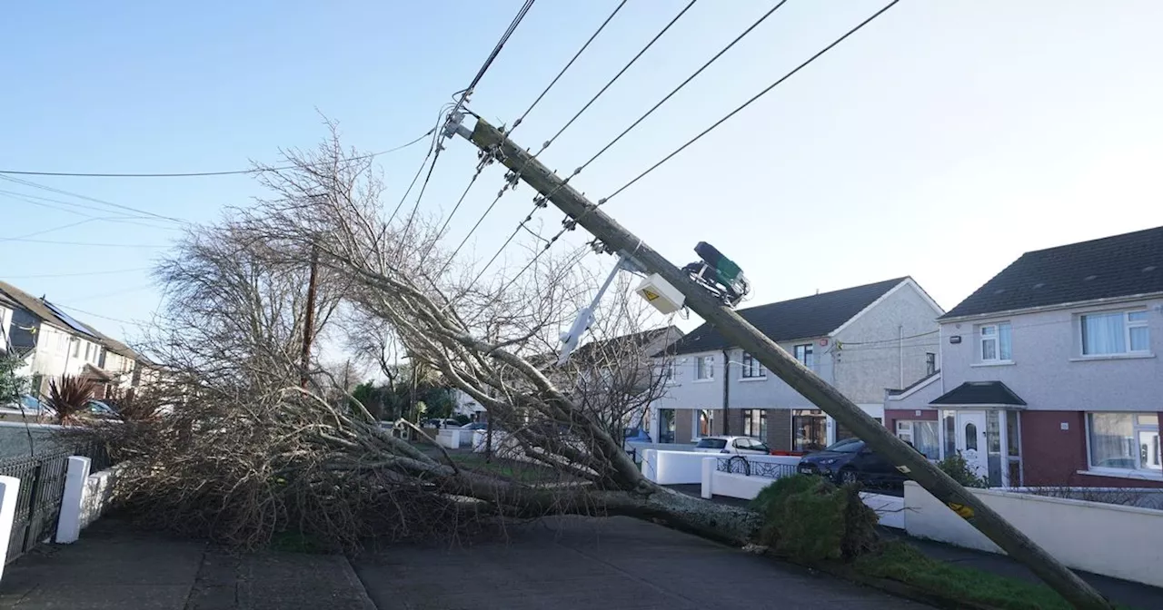 Storm Herminia Brings Multiple Weather Warnings to Ireland and Northern IrelandStorm Herminia is approaching Ireland and Northern Ireland, prompting multiple weather warnings. Met Éireann issued wind and rain warnings for various counties in the Republic of Ireland, while the UK Met Office issued a snow and ice warning for Northern Ireland. The warnings come after the devastation caused by Storm Eowyn and advise of potential strong winds, heavy rainfall, snow showers, and icy patches, leading to dangerous travel conditions.
Read more »
 Storm Eowyn Batters Ireland with Record-Breaking Winds, Leaving Hundreds of Thousands Without PowerStorm Eowyn, the strongest storm to hit Ireland on record, caused widespread disruption with record-breaking wind speeds, power outages, and school closures.
Read more »