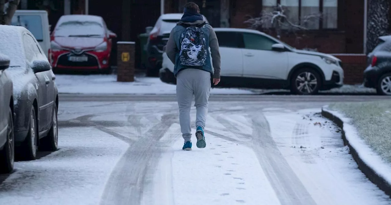
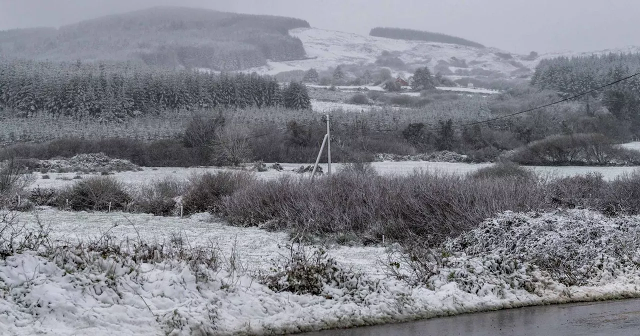
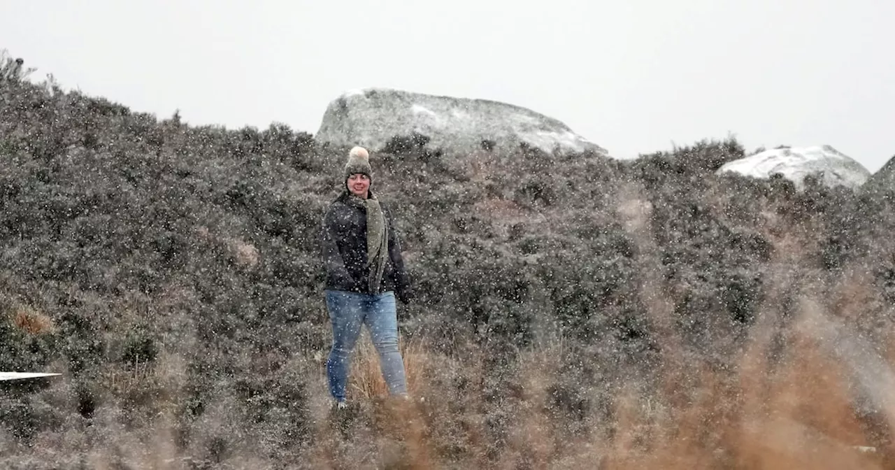
Ireland is bracing for more unsettled weather conditions, with Met Eireann issuing a range of weather warnings for various parts of the country. Expect heavy downpours, strong winds, and potential for snow and ice in the coming days.
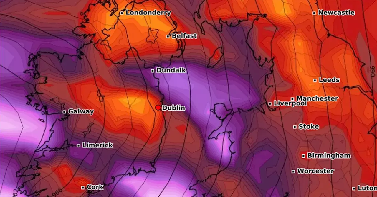
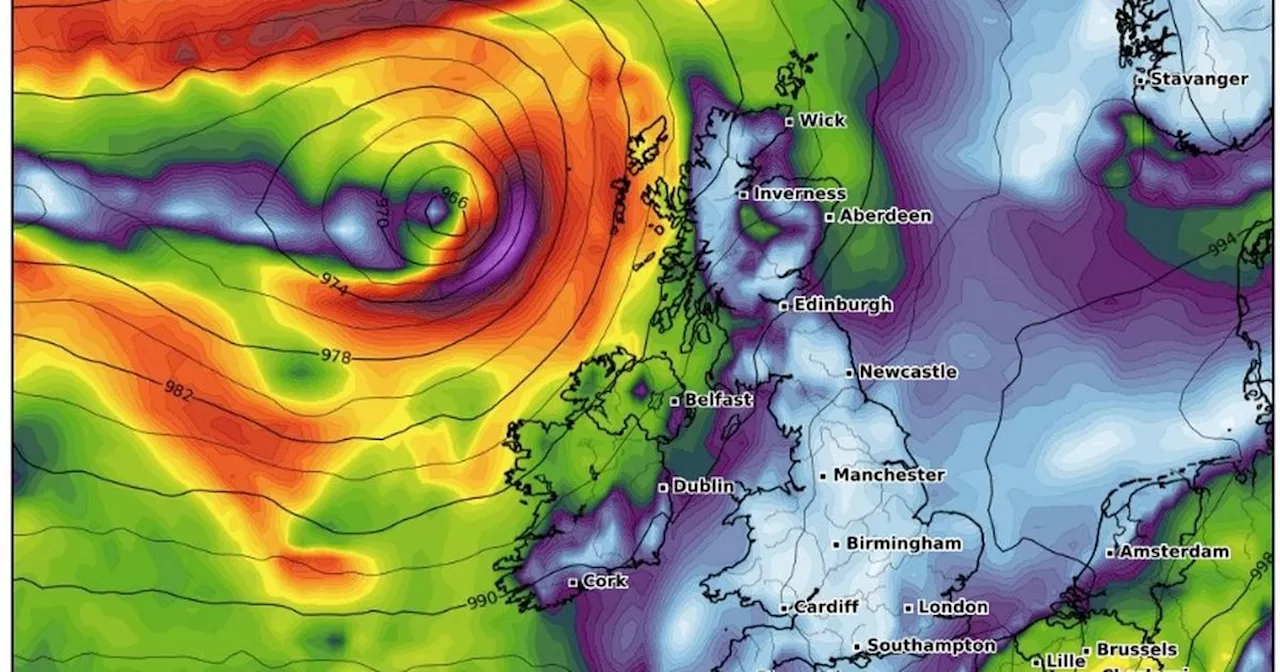
More winds and heavy downpours are on the way, as Met Eireann have issued fresh weather warnings. There is a Status Yellow snow and ice warning for Donegal, Leitrim, Mayo and Sligo. It is valid from 8PM on Saturday, 25 January until 9AM on Sunday, 26 January. It reads: “Scattered snow showers becoming isolated overnight with icy stretches.” There is a Status Yellow rain warning for Carlow, Kilkenny, Wicklow, Cork, Kerry, Tipperary and Waterford.
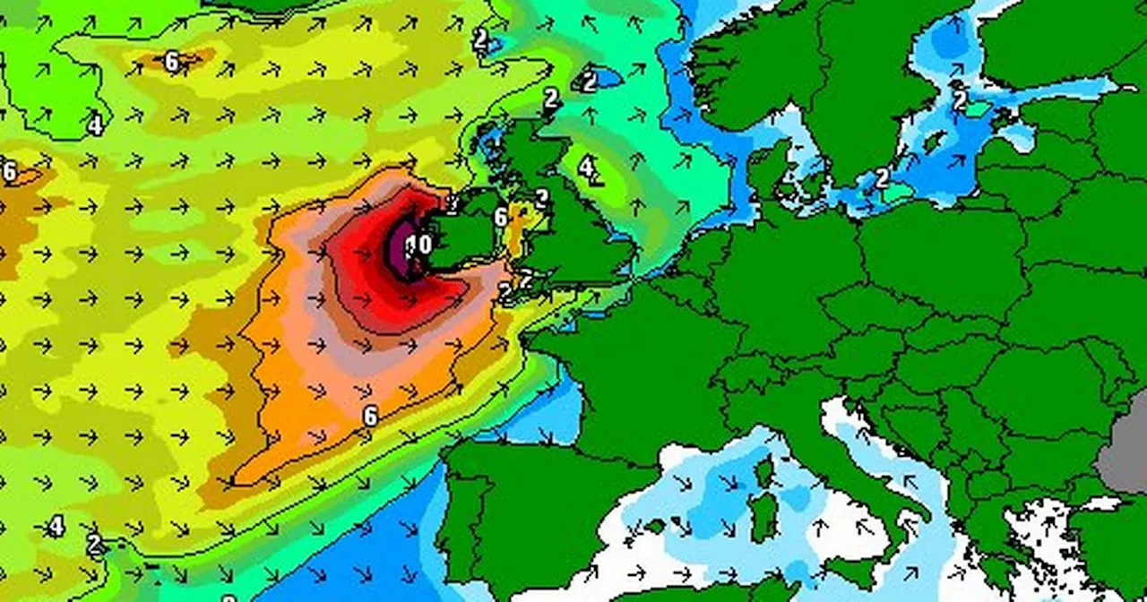
It is valid from 5AM on Sunday, 26 January until 5PM on the same day. It states: “Heavy downpours of rain may lead to spot flooding.” There is a Status Yellow wind warning for Carlow, Dublin, Kilkenny, Wexford, Wicklow, Munster, Galway, Mayo and Sligo. It is valid from 6AM on Sunday, 26 January until 6PM on the same day. It says: “Strong and gusty winds. Impacts: Further damage to already weakened structures and trees. Dangerous travelling conditions.” A Status Yellow wind warning is also in place for Donegal, Leitrim, Louth and Meath. It is valid from 11AM on Sunday, 26 January until 6PM on the same day. It states: “Strong and gusty winds. Impacts: Further damage to already weakened structures and trees. Dangerous travelling conditions.” There is a Status Yellow wind warning in place for Cork, Kerry and Waterford. It is valid from 11PM on Sunday, 26 January until 6AM on Monday, 27 January. It reads: “Strong and gusty winds. Impacts: Further damage to already weakened structures and trees. Dangerous travelling conditions.” The weather forecaster explained that it will be unsettled with frequent spells of rain or showers. People can expect it to be breezy or rather windy at times too. However, there are indications of improving conditions from Thursday. Met Eireann added: “Our weather will then become more settled with a ridge of high pressure building with a lot of dry weather developing for the latter half of the week”. Looking ahead to next week, Monday 27 January to Sunday 2 February, the national forecaster also noted that it will remain unsettled until the beginning of February with low pressure dominating our weather. Met.ie wrote: “This will bring frequent spells of rain and showers, with windy conditions possible at times also. Rainfall will be above average nationwide, with highest accumulations across the west and southwest. “Temperatures will also be above average across the country. Given the unsettled conditions, there is potential for wind and rain warnings throughout the period.” Here is your weather forecast for the week ahead: Saturday, 25 January Cold this morning with frost and icy patches, along with scattered wintry showers, mainly in the north and west. Sunny spells will develop but it will turn cloudier for a time as showery rain tracks eastwards across the country through the afternoon and early evening followed by showers. Falls of sleet are likely along with some hail and isolated thunderstorms. Light southerly winds will increase moderate to fresh and gusty for a time. Highest temperatures of 4 to 8 degrees. Cold tonight but dry for many with clear spells at first along with some wintry showers, mainly in the west and northwest. The showers will become isolated through the night and cloud will build from the southwest. Lowest temperatures of -3 to +1 degrees with widespread frost and some ice developing. Light to moderate southerly winds will back southeasterly and freshen in the southwest towards morning. Sunday, 26 January Turning wet and windy tomorrow with strong to near gale force southeasterly winds developing in the morning, with gale force winds along exposed coasts. Rain in the southwest will extend northeastwards through the morning and afternoon, with localised flooding possible, especially in southern parts. The rain will clear northwards in the evening as sunny spells and scattered showers follow with a chance of thunderstorms. The winds will veer southerly and will ease moderate to fresh as the rain clears. Highest temperatures of 6 to 10 degrees generally, cooler in the northwest. Scattered showers, merging to longer spells of rain at times, will continue to push in from the southwest through the night, most frequent in the south and west with the driest conditions in the north. Lowest temperatures of 2 to 6 degrees with mostly moderate to fresh southerly winds, stronger in the southwest and west. Monday, 27 January A rather windy day with showery outbreaks of rain, heavy in places with the chance of spot flooding and isolated thunderstorms. However, there will be some dry and bright spells too. Highest temperatures of 7 to 10 degrees generally, slightly cooler in the northwest. Fresh and gusty southerly winds will become cyclonic variable for a time before becoming northwesterly during the evening. Showery outbreaks of rain will continue overnight, still heavy in places but becoming mostly confined to the northwest by mornin
MET EIREANN WEATHER WARNINGS IRELAND WIND RAIN SNOW FLOODING
Ireland Latest News, Ireland Headlines
Similar News:You can also read news stories similar to this one that we have collected from other news sources.
 Met Eireann Issues Snow and Ice Warnings for IrelandMet Eireann warns of significant snowfall and bitterly cold conditions over the next few days in Ireland. A Status Yellow Low Temperature/Ice warning is in effect for the country.
Read more »
 Ireland Braces for Weekend Snow and Sleet as Met Éireann Issues Multiple WarningsMet Éireann has issued a series of weather warnings for Ireland, predicting 24 hours of snow and sleet across the country as temperatures drop. Status Orange and Yellow warnings have been issued for various counties, advising of hazardous travel conditions, potential flooding, and animal welfare concerns.
Read more »
 Met Éireann Issues Multiple Weather Warnings as Ireland Faces Snow and SleetMet Éireann has issued a series of weather warnings ahead of the weekend, predicting 24 hours of snow and sleet across Ireland. The warnings include a Status Orange Snow-Ice warning and a Status Yellow Rain and Snow warning, highlighting potential hazards like hazardous travel conditions and animal welfare concerns.
Read more »
 Met Éireann Issues Extensive Winter Warnings for IrelandMet Éireann has issued a range of weather warnings, including Status Orange warnings for rain and snow in the south and southeast, and Status Orange and Yellow warnings for snow and ice across the country. The warnings are in place until Thursday.
Read more »
 Ireland in Atlantic storms' firing line as Met Eireann issues major updateThe milder conditions are expected to dip below freezing at the beginning of the week when temperatures are predicted to drop as low as -2°C
Read more »
 Met Eireann issues weather advisory for all of Ireland as storm risk loomsThe national forecaster has issued the advisory as conditions are expected to turn unsettled in the coming days
Read more »